Home

Download Mobile App: Android Download Mobile App: Android

Select your language

  • DE
  • EN
  • Home
  • Interactive map
  • About the App
  • Habitats
      • Back
      • Urban & Gardens
      • Agriculture
      • Grassland & Shrubs
      • Forests
      • Mountains & Rocks
      • Dunes & Deserts
      • Freshwater
      • Marine & Coasts
      • Other
  • Blog
  • Nature observations
  1. You are here:  
  2. Home
  3. Habitats
  4. Forests

Forests

Mangroves

A mangrove is a shrub or small tree that grows in coastal saline or brackish water. The term is also used for tropical coastal vegetation consisting of such species. Mangroves occur worldwide in the tropics and subtropics, mainly between latitudes 30° N and 30° S, with the greatest mangrove area with 5° of the equator. The total mangrove forest area of the world in 2000 was 137,800 km2 (53,200 sq mi), spanning 118 countries and territories.

Mangroves are salt-tolerant trees, also called halophytes, and are adapted to life in harsh coastal conditions. They contain a complex salt filtration system and complex root system to cope with saltwater immersion and wave action. They are adapted to the low-oxygen conditions of waterlogged mud.

The word "mangrove" is used in at least three senses: most broadly to refer to the habitat and entire plant assemblage or mangal,for which the terms mangrove forest biome, and mangrove swamp are also used, to refer to all trees and large shrubs in a mangrove swamp, and narrowly to refer just to "true" mangrove trees of the genus Rhizophora of the family Rhizophoraceae.

The mangrove biome, or mangal, is a distinct saline woodland or shrubland habitat characterized by depositional coastal environments, where fine sediments (often with high organic content) collect in areas protected from high-energy wave action. The saline conditions tolerated by various mangrove species range from brackish water, through pure seawater (3 to 4% salinity), to water concentrated by evaporation to over twice the salinity of ocean seawater (up to 9% salinity).[5]

Ecology

Mangrove swamps (mangals) are found in tropical and subtropical tidal areas. Areas where mangroves occur include estuaries and marine shorelines.

World map mangrove distribution

Graphic: ChandraGiri (Wikimedia), Licence: CC-BY-SA-3.0


The intertidal existence to which these trees are adapted represents the major limitation to the number of species able to thrive in their habitat. High tide brings in salt water, and when the tide recedes, solar evaporation of the seawater in the soil leads to further increases in salinity. The return of tide can flush out these soils, bringing them back to salinity levels comparable to that of seawater.

At low tide, organisms are also exposed to increases in temperature and reduced moisture before being then cooled and flooded by the tide. Thus, for a plant to survive in this environment, it must tolerate broad ranges of salinity, temperature, and moisture, as well as a number of other key environmental factors—thus only a select few species make up the mangrove tree community.

About 110 species are considered mangroves, in the sense of being trees that grow in such a saline swamp, though only a few are from the mangrove plant genus, Rhizophora. However, a given mangrove swamp typically features only a small number of tree species. It is not uncommon for a mangrove forest in the Caribbean to feature only three or four tree species. For comparison, the tropical rainforest biome contains thousands of tree species, but this is not to say mangrove forests lack diversity. Though the trees themselves are few in species, the ecosystem that these trees create provides a home (habitat) for a great variety of other species, including as many as 174 species of marine megafauna.


Source: Wikipedia contributors. "Mangrove." Wikipedia, The Free Encyclopedia. Wikipedia, The Free Encyclopedia, 25 Jun. 2021. Web. 28 Jun. 2021.


Tropical forest

Tropical forests are forested landscapes in tropical regions: i.e. land areas approximately bounded by the tropic of Cancer and Capricorn, but possibly affected by other factors such as prevailing winds.

Some tropical forest types are difficult to categorise. While forests in temperate areas are readily categorised on the basis of tree canopy density, such schemes do not work well in tropical forests. There is no single scheme that defines what a forest is, in tropical regions or elsewhere. Because of these difficulties, information on the extent of tropical forests varies between sources. However, Tropical Forests are extensive, making up just under half the world’s forests. The tropical domain has the largest proportion of the world’s forests (45 percent), followed by the boreal, temperate and subtropical domains.

More than 3.6m hectares of virgin tropical forest was lost in 2018.

Types of tropical forest

Tropical forests are often thought of as evergreen rainforests and moist forests, but these account for only a portion of them (depending on how they are defined - see maps). The remaining tropical forests are a diversity of many different forest types including: Eucalyptus open forest, tropical coniferous forests, savanna woodland (e.g. Sahelian forest), and mountain forests (the higher elevations of which are cloud forests). Over even relatively short distances, the boundaries between these biomes may be unclear, with ecotones between the main types.

The nature of tropical forest in any given area is affected by a number of factors, most importantly:

Geographical: location and climatic zone (see sub-types), with:

  • Precipitation levels and seasonality, with strong dry seasons significantly affecting flora (e.g. the predominance of lianas);
  • Temperature profile, which is relatively even in equatorial rainforest or with a cooler season towards subtropical latitudes;
  • Elevation affects the above, often creating "ecological islands" with high endemism (e.g. Mount Kinabalu in the Borneo rainforest).


Historical: prehistoric age of forest and level of recent disturbance (see threats), changing primary (usually maximum biodiversity) into secondary forest, degenerating into bamboo forest after prolonged swidden agriculture (e.g. in several areas of Indo-China).


Soil characteristics (also subject to various classifications): including depth and drainage.


Source: Wikipedia contributors. "Tropical forest." Wikipedia, The Free Encyclopedia. Wikipedia, The Free Encyclopedia, 25 May. 2021. Web. 28 Jun. 2021.

Mediterranean forest

Mediterranean forests, woodlands, and scrub is a biome defined by the World Wide Fund for Nature. The biome is generally characterized by dry summers and rainy winters, although in some areas rainfall may be uniform. Summers are typically hot in low-lying inland locations but can be cool near colder seas. Winters are typically mild to cool in low-lying locations but can be cold in inland and higher locations. All these ecoregions are highly distinctive, collectively harbouring 10% of the Earth's plant species.

Vegetation types range from forests to woodlands, savannas, shrublands, and grasslands; "mosaic habitat" landscapes are common, where differing vegetation types are interleaved with one another in complex patterns created by variations in soil, topography, exposure to wind and sun, and fire history. Much of the woody vegetation in Mediterranean-climate regions is sclerophyll, which means 'hard-leaved' in Greek. Sclerophyllous vegetation generally has small, dark leaves covered with a waxy outer layer to retain moisture in the dry summer months.

Mediterranean forests are generally composed of broadleaf trees, such as the oak and mixed sclerophyll forests of California and the Mediterranean region, the Eucalyptus forests of Southwest Australia, and the Nothofagus forests of central Chile. Forests are often found in riparian areas, where they receive more summer water. Coniferous forests also occur, especially around the Mediterranean. Pine and deciduous oak forest are widespread across California.

Source: Wikipedia contributors. "Mediterranean forests, woodlands, and scrub." Wikipedia, The Free Encyclopedia. Wikipedia, The Free Encyclopedia, 31 May. 2021. Web. 28 Jun. 2021.

Riparian forest

A riparian forest or riparian woodland is a forested or wooded area of land adjacent to a body of water such as a river, stream, pond, lake, marshland, estuary, canal, sink or reservoir. The term riparian comes from the Latin word ripa, 'river bank'; though, technically it only refers to areas adjacent to flowing bodies of water such as rivers, streams, sloughs, and estuaries. However, the terms riparian forest and riparian zone have come to include areas adjacent to non-flowing bodies of water such as ponds, lakes, playas and reservoirs.

Characteristics

  • Riparian forests are subject to frequent inundation.
  • Riparian forests help control sediment, reduce the damaging effects of flooding and aid in stabilizing stream banks.
  • Riparian zones are transition zones between an upland terrestrial environment and an aquatic environment. Organisms found in this zone are adapted to periodic flooding. Many not only tolerate it, but require it in order to maintain health and complete their lifestyles.


Source: Wikipedia contributors. "Riparian forest." Wikipedia, The Free Encyclopedia. Wikipedia, The Free Encyclopedia, 5 Dec. 2020. Web. 28 Jun. 2021. 

Temperate forest

A temperate forest is a forest found between the tropical and boreal regions, located in the temperate zone. It is the second largest biome on the planet, covering 25% of the world's forest area, only behind the boreal forest, which covers about 33%. These forests cover both hemispheres at latitudes ranging from 25 to 50 degrees, wrapping the planet in a belt similar to that of the boreal forest. Due to its large size spanning several continents, there are several main types: deciduous, coniferous, mixed forest and rainforest.

Climate

The climate of a temperate forest is highly variable depending on the location of the forest. For example, Los Angeles and Vancouver, Canada are both considered to be located in a temperate zone, however, Vancouver is located in a temperate rainforest, while Los Angeles is more subtropical. Temperate forests typically have winters that often reach below freezing, however even this is not always true. The East Coast forests retain their deciduous nature largely due to the excessive freezing days each winter, as the leaves often freeze over and are only designed to live for one season. Milder areas such as the southern coast of British Columbia where the average winter lows are above freezing often have evergreen rainforests.


Source: Wikipedia contributors. "Temperate forest." Wikipedia, The Free Encyclopedia. Wikipedia, The Free Encyclopedia, 17 Jun. 2021. Web. 28 Jun. 2021.

Boreal forest

Taiga, generally referred to in North America as boreal forest or snow forest, is a biome characterized by coniferous forests consisting mostly of pines, spruces, and larches.

The taiga or boreal forest has been called the world's largest land biome. In North America, it covers most of inland Canada, Alaska, and parts of the northern contiguous United States. In Eurasia, it covers most of Sweden, Finland, much of Russia from Karelia in the west to the Pacific Ocean (including much of Siberia), much of Norway and Estonia, some of the Scottish Highlands,[citation needed] some lowland/coastal areas of Iceland, and areas of northern Kazakhstan, northern Mongolia, and northern Japan (on the island of Hokkaidō).

The main tree species, the length of the growing season and summer temperatures vary across the world. The taiga of North America is mostly spruce, Scandinavian and Finnish taiga consists of a mix of spruce, pines and birch, Russian taiga has spruces, pines and larches depending on the region, while the Eastern Siberian taiga is a vast larch forest.

Taiga in its current form is a relatively recent phenomenon, having only existed for the last 12,000 years since the beginning of the Holocene epoch, covering land that had been mammoth steppe or under the Scandinavian Ice Sheet in Eurasia and under the Laurentide Ice Sheet in North America during the Late Pleistocene.

Although at high elevations taiga grades into alpine tundra through Krummholz, it is not exclusively an alpine biome, and unlike subalpine forest, much of taiga is lowlands.

The term "taiga" is not used consistently by all cultures. In the English language, "boreal forest" is used in the United States and Canada in referring to more southerly regions, while "taiga" is used to describe the more northern, barren areas approaching the tree line and the tundra. Hoffman (1958) discusses the origin of this differential use in North America and how this differentiation distorts established Russian usage.

Climate change is a threat, and how the carbon dioxide absorbed should be treated by carbon accounting is controversial

Flora

Since North America and Asia used to be connected by the Bering land bridge, a number of animal and plant species (more animals than plants) were able to colonize both continents and are distributed throughout the taiga biome (see Circumboreal Region). Others differ regionally, typically with each genus having several distinct species, each occupying different regions of the taiga. Taigas also have some small-leaved deciduous trees like birch, alder, willow, and poplar; mostly in areas escaping the most extreme winter cold. However, the Dahurian larch tolerates the coldest winters in the Northern Hemisphere in eastern Siberia. The very southernmost parts of the taiga may have trees such as oak, maple, elm and lime scattered among the conifers, and there is usually a gradual transition into a temperate mixed forest, such as the eastern forest-boreal transition of eastern Canada. In the interior of the continents with the driest climate, the boreal forests might grade into temperate grassland.

There are two major types of taiga. The southern part is the closed canopy forest, consisting of many closely spaced trees with mossy ground cover. In clearings in the forest, shrubs and wildflowers are common, such as the fireweed. The other type is the lichen woodland or sparse taiga, with trees that are farther-spaced and lichen ground cover; the latter is common in the northernmost taiga. In the northernmost taiga the forest cover is not only more sparse, but often stunted in growth form; moreover, ice pruned asymmetric black spruce (in North America) are often seen, with diminished foliage on the windward side. In Canada, Scandinavia and Finland, the boreal forest is usually divided into three subzones: The high boreal (north boreal) or taiga zone; the middle boreal (closed forest); and the southern boreal, a closed canopy boreal forest with some scattered temperate deciduous trees among the conifers, such as maple, elm and oak. This southern boreal forest experiences the longest and warmest growing season of the biome, and in some regions (including Scandinavia, Finland and western Russia) this subzone is commonly used for agricultural purposes. The boreal forest is home to many types of berries; some are confined to the southern and middle closed boreal forest (such as wild strawberry and partridgeberry); others grow in most areas of the taiga (such as cranberry and cloudberry), and some can grow in both the taiga and the low arctic (southern part of) tundra (such as bilberry, bunchberry and lingonberry).

The forests of the taiga are largely coniferous, dominated by larch, spruce, fir and pine. The woodland mix varies according to geography and climate so for example the Eastern Canadian forests ecoregion of the higher elevations of the Laurentian Mountains and the northern Appalachian Mountains in Canada is dominated by balsam fir Abies balsamea, while further north the Eastern Canadian Shield taiga of northern Quebec and Labrador is notably black spruce Picea mariana and tamarack larch Larix laricina.

Evergreen species in the taiga (spruce, fir, and pine) have a number of adaptations specifically for survival in harsh taiga winters, although larch, which is extremely cold-tolerant, is deciduous. Taiga trees tend to have shallow roots to take advantage of the thin soils, while many of them seasonally alter their biochemistry to make them more resistant to freezing, called "hardening". The narrow conical shape of northern conifers, and their downward-drooping limbs, also help them shed snow.

Because the sun is low in the horizon for most of the year, it is difficult for plants to generate energy from photosynthesis. Pine, spruce and fir do not lose their leaves seasonally and are able to photosynthesize with their older leaves in late winter and spring when light is good but temperatures are still too low for new growth to commence. The adaptation of evergreen needles limits the water lost due to transpiration and their dark green color increases their absorption of sunlight. Although precipitation is not a limiting factor, the ground freezes during the winter months and plant roots are unable to absorb water, so desiccation can be a severe problem in late winter for evergreens.

Although the taiga is dominated by coniferous forests, some broadleaf trees also occur, notably birch, aspen, willow, and rowan. Many smaller herbaceous plants, such as ferns and occasionally ramps grow closer to the ground. Periodic stand-replacing wildfires (with return times of between 20 and 200 years) clear out the tree canopies, allowing sunlight to invigorate new growth on the forest floor. For some species, wildfires are a necessary part of the life cycle in the taiga; some, e.g. jack pine have cones which only open to release their seed after a fire, dispersing their seeds onto the newly cleared ground; certain species of fungi (such as morels) are also known to do this. Grasses grow wherever they can find a patch of sun, and mosses and lichens thrive on the damp ground and on the sides of tree trunks. In comparison with other biomes, however, the taiga has low biological diversity.

Coniferous trees are the dominant plants of the taiga biome. A very few species in four main genera are found: the evergreen spruce, fir and pine, and the deciduous larch. In North America, one or two species of fir and one or two species of spruce are dominant. Across Scandinavia and western Russia, the Scots pine is a common component of the taiga, while taiga of the Russian Far East and Mongolia is dominated by larch. Rich in spruces, Scots pines in the western Siberian plain, the taiga is dominated by larch in Eastern Siberia, before returning to its original floristic richness on the Pacific shores. Two deciduous trees mingle throughout southern Siberia: birch and Populus tremula.


Source: Wikipedia contributors. "Taiga." Wikipedia, The Free Encyclopedia. Wikipedia, The Free Encyclopedia, 26 Jun. 2021. Web. 28 Jun. 2021.

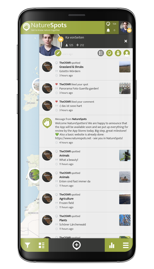
NatureSpots App with plants and leaves

Get the free App!

NatureSpots is a non-profit and 100% community-driven project. We run it because we love to discover our world and share our findings with others. The app does not contain any ads and we do not get money from this project at all. Download the App on your Smartphone and join up!

Android AppStoreBadge 150x45px IOS AppStoreBadge 150x45px

Want to partner up for a new biodiversity experience?

We are looking for partners, who are interested in biodiversity data, Citizen Science and being part of a modern and unique app. NatureSpots App is running on the SPOTTERON Citizen Science platform and provides a wide range of interactive features. For partners, we can provide communication tools, access to the data administration interface and download of occurrence records without any costs.

Please get in contact via office@spotteron.net if you are interested in joining NatureSpots with your organization! Let's talk about the future of biodiversity monitoring and how we can work best together!


  • More free Apps
Home
SPOTTERON Citizen Science Platform Logo This project website is powered by SPOTTERON Citizen Science