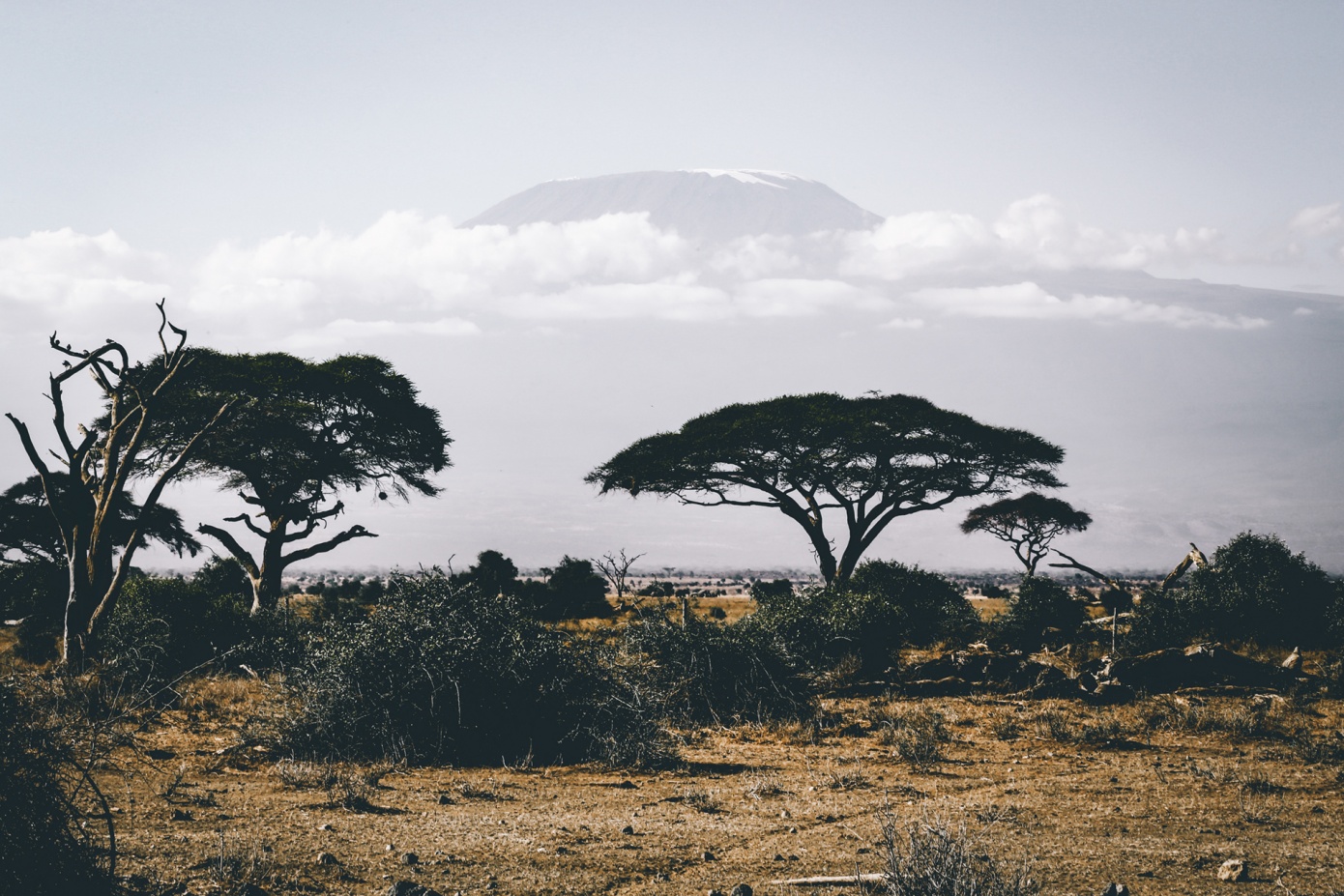
A savanna or savannah is a mixed woodland-grassland ecosystem characterised by the trees being sufficiently widely spaced so that the canopy does not close. The open canopy allows sufficient light to reach the ground to support an unbroken herbaceous layer consisting primarily of grasses.
Savannas maintain an open canopy despite a high tree density. It is often believed that savannas feature widely spaced, scattered trees. However, in many savannas, tree densities are higher and trees are more regularly spaced than in forests. The South American savanna types cerrado sensu stricto and cerrado dense typically have densities of trees similar to or higher than that found in South American tropical forests, with savanna ranging from 800–3300 trees per hectare (trees/ha) and adjacent forests with 800–2000 trees/ha. Similarly Guinean savanna has 129 trees/ha, compared to 103 for riparian forest, while Eastern Australian sclerophyll forests have average tree densities of approximately 100 per hectare, comparable to savannas in the same region.
Savannas are also characterised by seasonal water availability, with the majority of rainfall confined to one season; they are associated with several types of biomes, and are frequently in a transitional zone between forest and desert or grassland. Savanna covers approximately 20% of the Earth's land area.
Distribution
Many grassy landscapes and mixed communities of trees, shrubs, and grasses were described as savanna before the middle of the 19th century, when the concept of a tropical savanna climate became established. The Köppen climate classification system was strongly influenced by effects of temperature and precipitation upon tree growth, and his oversimplified assumptions resulted in a tropical savanna classification concept which resulted in it being considered as a "climatic climax" formation. The common usage meaning to describe vegetation now conflicts with a simplified yet widespread climatic concept meaning. The divergence has sometimes caused areas such as extensive savannas north and south of the Congo and Amazon Rivers to be excluded from mapped savanna categories.
"Barrens" has been used almost interchangeably with savanna in different parts of North America. Sometimes midwestern savanna were described as "grassland with trees". Different authors have defined the lower limits of savanna tree coverage as 5–10% and upper limits range as 25–80% of an area.
Two factors common to all savanna environments are rainfall variations from year to year, and dry season wildfires. In the Americas, e.g. in Belize, Central America, savanna vegetation is similar from Mexico to South America and to the Caribbean.
Over many large tropical areas, the dominant biome (forest, savanna or grassland) can not be predicted only by the climate, as historical events plays also a key role, for example, fire activity.[24] In some areas, indeed, it is possible for there to be multiple stable biomes.
Source: Source: Wikipedia contributors. "Savanna." Wikipedia, The Free Encyclopedia. Wikipedia, The Free Encyclopedia, 20 Jan. 2021. Web. 28 Jun. 2021.