
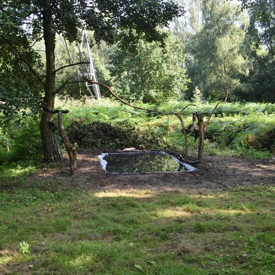
 "Biete mehr Wasser und Stöcke für die Eichhörnchen" says Danny VG in habitat Backyard on 04.09.2021..
 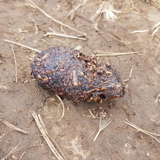 "Gemsenkot vermutlich. Viele Ballaststoff :D
#gemse #kot #ötscher #wandern" says Ka vonSeiten in nature on 05.09.2021. Chamois (Rupicapra rupicapra) is a species of mammal.
"Gemsenkot vermutlich. Viele Ballaststoff :D
#gemse #kot #ötscher #wandern" says Ka vonSeiten in nature on 05.09.2021. Chamois (Rupicapra rupicapra) is a species of mammal.  A discovery by Danny VG in habitat Mountain meadows on 03.09.2021. Leptidea sinapis (Leptidea sinapis) is a species of insect.
 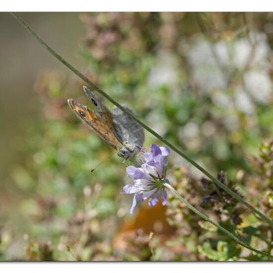 A discovery by Danny VG in habitat Mountain meadows on 03.09.2021. Lasiommata megera (Lasiommata megera) is a species of insect.
 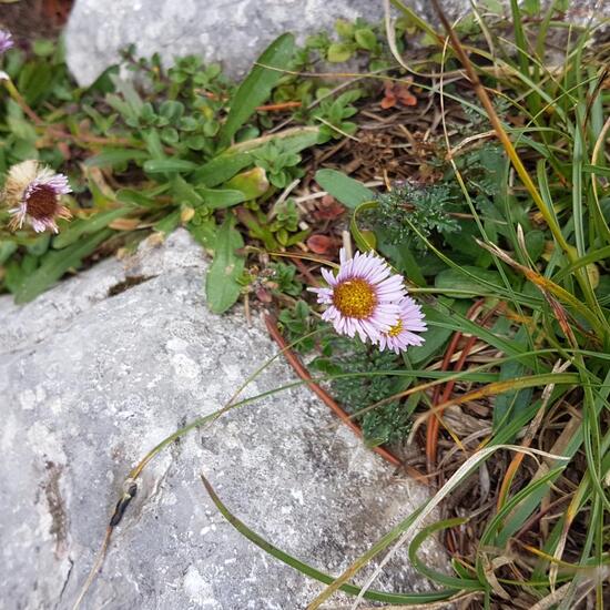 "Fast wie Gänseblümchen, aber anders.. Was könnte das sein?
#blume #ötscher #wandern" says Ka vonSeiten in habitat Alpine tundra on 04.09.2021. Unknown species.
"Fast wie Gänseblümchen, aber anders.. Was könnte das sein?
#blume #ötscher #wandern" says Ka vonSeiten in habitat Alpine tundra on 04.09.2021. Unknown species. 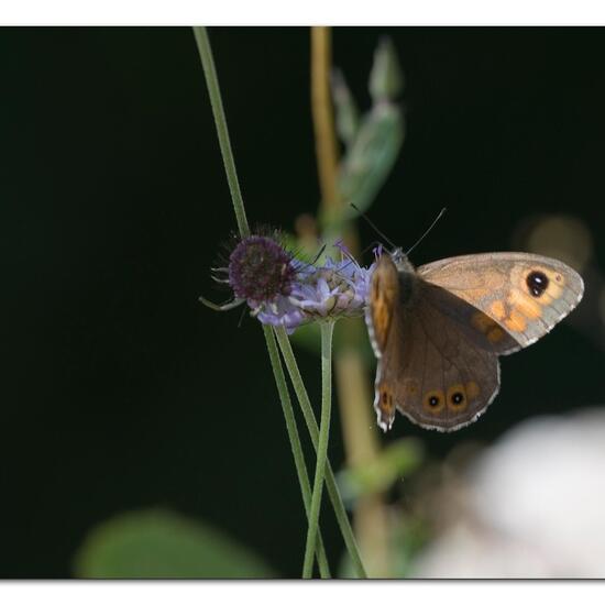 A discovery by Danny VG in habitat Mountain meadows on 03.09.2021. Lasiommata megera (Lasiommata megera) is a species of insect.
 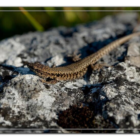 "Sie sind sehr selten, aber zahlreicher in diesem Biotop." says Danny VG in habitat Mountain meadows on 03.09.2021. Podarcis muralis (Podarcis muralis) is a species of reptile.
 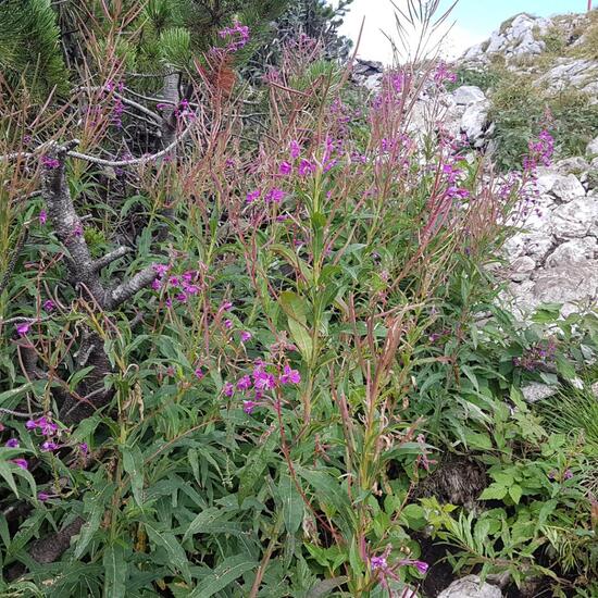 "Weidenröschen entlang des Weges, stimmt die Art?
#weidenröschen #ötscher #wandern" says Ka vonSeiten in habitat Rock areas on 04.09.2021. Chamaenerion angustifolium (Chamerion angustifolium) is a species of plant.
"Weidenröschen entlang des Weges, stimmt die Art?
#weidenröschen #ötscher #wandern" says Ka vonSeiten in habitat Rock areas on 04.09.2021. Chamaenerion angustifolium (Chamerion angustifolium) is a species of plant. 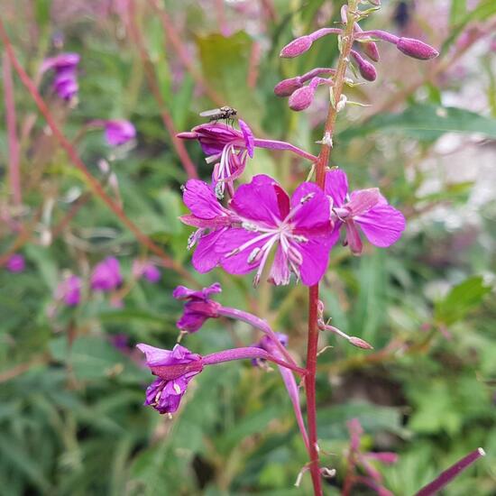 "Closeup der Blüte,
Weidenröschen am Ötscher.
Mit Fliege.
#ötscher #wandern #blüte #weidenröschen" says Ka vonSeiten in habitat Rock areas on 04.09.2021. Chamaenerion angustifolium (Chamerion angustifolium) is a species of plant.
"Closeup der Blüte,
Weidenröschen am Ötscher.
Mit Fliege.
#ötscher #wandern #blüte #weidenröschen" says Ka vonSeiten in habitat Rock areas on 04.09.2021. Chamaenerion angustifolium (Chamerion angustifolium) is a species of plant. 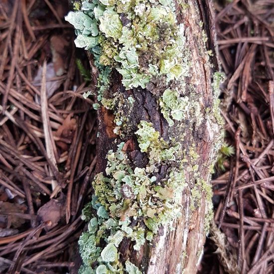 "Flechten auf den Latschen Kiefern.
#flechten #lichen #latschen #ötscher #wandern" says Ka vonSeiten in habitat Boreal forest on 04.09.2021. Unknown species.
"Flechten auf den Latschen Kiefern.
#flechten #lichen #latschen #ötscher #wandern" says Ka vonSeiten in habitat Boreal forest on 04.09.2021. Unknown species. 
Hey, do you love Nature?
Observing and learning about nature is fun and can help to protect our environment. In the NatureSpots App, you can put up all kinds of nature sightings - from species to habitats. Join up and help to build a biodiversity data set and share your photos!
Create your account or download the NatureSpots App for your Smartphone now to join the community!