Habitats

Habitats are the puzzle pieces of the natural environment. A wide range of habitat types exist, which can be observed with the NatureSpots App, ranging from Urban and human-made environments to natural environments like forests, grasslands or water bodies like freshwater habitats or the oceans. In the App, you can create timelines to ongoingly monitor changes and developments in habitats and help to protect nature together with the community.

In agriculture, a meadow is grassland which is not regularly grazed by domestic livestock, but rather allowed to grow unchecked in order to produce hay. Their roots go way back to the Iron Age when appropriate tools for the hay harvest emerged. The ability to produce livestock fodder on meadows had a significant advantage for livestock production, as animals could…
Alpine tundra is a type of natural region or biome that does not contain trees because it is at high elevation. As the latitude of a location approaches the poles, the threshold elevation for alpine tundra gets lower until it reaches sea level, and alpine tundra merges with polar tundra. The high elevation causes an adverse climate, which is too…
 A basin is an artificially created water basin. It is used, among other things, in geometric garden art because, in contrast to the artificial lake, it consists only of basic geometric shapes (e.g.: rectangle, circle, ellipse) or their combination (e.g.: rectangle with attached semicircle). In animal husbandry/zoo, large water pools are also referred to as basins. Quelle: Seite „Bassin“. In: Wikipedia –…
A bog or bogland is a wetland that accumulates peat, a deposit of dead plant material—often mosses, and in a majority of cases, sphagnum moss. It is one of the four main types of wetlands. Other names for bogs include mire, mosses, quagmire, and muskeg; alkaline mires are called fens.[clarification needed] A baygall is another type of bog found in…
Taiga, generally referred to in North America as boreal forest or snow forest, is a biome characterized by coniferous forests consisting mostly of pines, spruces, and larches. The taiga or boreal forest has been called the world's largest land biome. In North America, it covers most of inland Canada, Alaska, and parts of the northern contiguous United States. In Eurasia,…
Brackish water, also sometimes termed brack water, is water occurring in a natural environment having more salinity than freshwater, but not as much as seawater. It may result from mixing seawater (salt water) with fresh water together, as in estuaries, or it may occur in brackish fossil aquifers. The word comes from the Middle Dutch root "brak". Certain human activities…
In urban planning, brownfield land is any previously developed land that is not currently in use that may be potentially contaminated. The term is also used to describe land previously used for industrial or commercial purposes with known or suspected pollution including soil contamination due to hazardous waste. Locations and contaminants Generally, brownfield sites exist in a city's or town's…
A buffer strip is an area of land maintained in permanent vegetation that helps to control air, soil, and water quality, along with other environmental problems, dealing primarily on land that is used in agriculture. Buffer strips trap sediment, and enhance filtration of nutrients and pesticides by slowing down runoff that could enter the local surface waters. The root systems…
A cave or cavern is a natural void in the ground, specifically a space large enough for a human to enter. Caves often form by the weathering of rock and often extend deep underground. The word cave can also refer to much smaller openings such as sea caves, rock shelters, and grottos, though strictly speaking a cave is exogene, meaning…
Cold deserts, sometimes known as temperate deserts, occur at higher latitudes than hot deserts, and the aridity is caused by the dryness of the air. Some cold deserts are far from the ocean and others are separated by mountain ranges from the sea, and in both cases, there is insufficient moisture in the air to cause much precipitation. The largest…
A coral reef is an underwater ecosystem characterized by reef-building corals. Reefs are formed of colonies of coral polyps held together by calcium carbonate. Most coral reefs are built from stony corals, whose polyps cluster in groups. Coral belongs to the class Anthozoa in the animal phylum Cnidaria, which includes sea anemones and jellyfish. Unlike sea anemones, corals secrete hard…
A courtyard or court is a circumscribed area, often surrounded by a building or complex, that is open to the sky. Courtyards are common elements in both Western and Eastern building patterns and have been used by both ancient and contemporary architects as a typical and traditional building feature. Such spaces in inns and public buildings were often the primary…
Agricultural land is typically land devoted to agriculture, the systematic and controlled use of other forms of life—particularly the rearing of livestock and production of crops—to produce food for humans. It is generally synonymous with both farmland or cropland, as well as pasture or rangeland. The United Nations Food and Agriculture Organization (FAO) and others following its definitions, however, also…
The key characteristic of dry grasslands is that they have low-growing plants, causing the area to be quite open. They also have a mottled structure, which leads to a biome with sunny or semi-shaded areas. On top of that, their soil is relatively dry and nutrient-poor. There are, however, types of grasslands with a higher humus and nutrient content. The…
A dune is a landform composed of wind- or water-driven sand. It typically takes the form of a mound, ridge, or hill. An area with dunes is called a dune system or a dune complex. A large dune complex is called a dune field, while broad, flat regions covered with wind-swept sand or dunes with little or no vegetation are…
An endolith is an organism (archaeon, bacterium, fungus, lichen, algae or amoeba) that lives inside rock, coral, animal shells, or in the pores between mineral grains of a rock. Many are extremophiles, living in places long imagined inhospitable to life. They are of particular interest to astrobiologists, who theorize that endolithic environments on Mars and other planets constitute potential refugia…
Flooded grasslands and savannas is a terrestrial biome of the WWF biogeographical system, consisting of large expanses or complexes of flooded grasslands. These areas support numerous plants and animals adapted to the unique hydrologic regimes and soil conditions. Large congregations of migratory and resident waterbirds may be found in these regions. However, the relative importance of these habitat types for…
A garden is a planned space, usually outdoors, set aside for the display, cultivation, or enjoyment of plants and other forms of nature, as an ideal setting for social or solitary human life. The single feature identifying even the wildest wild garden is control. The garden can incorporate both natural and man-made materials. Gardens often have design features including statuary,…
The word horticulture is modelled after agriculture; it derives from the Latin words hortus and cultura, which mean “garden” and “cultivation”, respectively. In contrast to agriculture, horticulture does not include large-scale crop production or animal husbandry. Additionally, horticulture focuses on the use of small plots with a wide variety of mixed crops while agriculture focuses on one large primary crop…
A glacier is a persistent body of dense ice that is constantly moving under its own weight. A glacier forms where the accumulation of snow exceeds its ablation over many years, often centuries. Glaciers slowly deform and flow under stresses induced by their weight, creating crevasses, seracs, and other distinguishing features. They also abrade rock and debris from their substrate…
Guerrilla gardening is the act of gardening – raising food plants or flowers – on land that the gardeners do not have the legal rights to cultivate, such as abandoned sites, areas that are not being cared for, or private property. It encompasses a diverse range of people and motivations, ranging from gardeners who spill over their legal boundaries to…
Hedge A hedge or hedgerow is a line of closely spaced shrubs and sometimes trees, planted and trained to form a barrier or to mark the boundary of an area, such as between neighbouring properties. Hedges used to separate a road from adjoining fields or one field from another, and of sufficient age to incorporate larger trees, are known as…
A hot spring, hydrothermal spring, or geothermal spring is a spring produced by the emergence of geothermally heated groundwater onto the surface of the Earth. The groundwater is heated either by shallow bodies of magma (molten rock) or by circulation through faults to hot rock deep in the Earth's crust. In either case, the ultimate source of the heat is…
A hydrothermal vent is a fissure on the seafloor from which geothermally heated water discharges. Hydrothermal vents are commonly found near volcanically active places, areas where tectonic plates are moving apart at spreading centers, ocean basins, and hotspots. Hydrothermal deposits are rocks and mineral ore deposits formed by the action of hydrothermal vents. Hydrothermal vents exist because the earth is…
A greenhouse (also called a glasshouse, or, if with sufficient heating, a hothouse) is a structure with walls and roof made chiefly of transparent material, such as glass, in which plants requiring regulated climatic conditions are grown. These structures range in size from small sheds to industrial-sized buildings. A miniature greenhouse is known as a cold frame. The interior of…
Industrial region or industrial area refers to a geographical region with extremely dense industry. It is usually heavily urbanized. Industrial parks are usually located on the edges of, or outside, the main residential area of a city, and are normally provided with good transportation access, including road and rail. One such example is the large number of industrial estates located…
A lake is an area filled with water, localized in a basin, surrounded by land, apart from any river or other outlet that serves to feed or drain the lake. Lakes lie on land and are not part of the ocean, although like the much larger oceans, they form part of earth's water cycle. Lakes are distinct from lagoons which…
Maquis (French) or macchia (Italian: macchia mediterranea) is a shrubland biome in the Mediterranean region, typically consisting of densely growing evergreen shrubs. Source: Wikipedia contributors. "Maquis shrubland." Wikipedia, The Free Encyclopedia. Wikipedia, The Free Encyclopedia, 2 Mar. 2021. Web. 28 Jun. 2021.
A mangrove is a shrub or small tree that grows in coastal saline or brackish water. The term is also used for tropical coastal vegetation consisting of such species. Mangroves occur worldwide in the tropics and subtropics, mainly between latitudes 30° N and 30° S, with the greatest mangrove area with 5° of the equator. The total mangrove forest area…
Mediterranean forests, woodlands, and scrub is a biome defined by the World Wide Fund for Nature. The biome is generally characterized by dry summers and rainy winters, although in some areas rainfall may be uniform. Summers are typically hot in low-lying inland locations but can be cool near colder seas. Winters are typically mild to cool in low-lying locations but…
The microscopic scale is the scale of objects and events smaller than those that can easily be seen by the naked eye, requiring a lens or microscope to see them clearly. In physics, the microscopic scale is sometimes regarded as the scale between the macroscopic scale and the quantum scale. Microscopic units and measurements are used to classify and describe…
Alpine meadows form where sediments from the weathering of rocks has produced soils well-developed enough to support grasses and sedges. Non-flowering lichens cling to rocks and soil. Their enclosed algal cells can photosynthesize at any temperature above 0 °C (32 °F), and the outer fungal layers can absorb more than their own weight in water. The adaptations for survival of…
Mudflats or mud flats, also known as tidal flats, are coastal wetlands that form in intertidal areas where sediments have been deposited by tides or rivers. A recent global analysis suggested they are as extensive globally as mangroves. They are found in sheltered areas such as bays, bayous, lagoons, and estuaries; they are also seen in freshwater lakes and salty…
A meadow is an open habitat, or field, vegetated by grass, herbs and other non-woody plants. Meadows may be sparsely covered with trees or shrubs, as long as they maintain an open character. They may be naturally occurring or artificially created from cleared shrub or woodland. They can occur naturally under favourable conditions (see perpetual meadows), but they are often…
Oceanic islands are islands that do not sit on continental shelves. The vast majority are volcanic in origin, such as Saint Helena in the South Atlantic Ocean. The few oceanic islands that are not volcanic are tectonic in origin and arise where plate movements have lifted up the ocean floor above the surface. Examples are Saint Peter and Paul Rocks…
The sea, connected as the world ocean or simply the ocean, is the body of salty water that covers over 70 percent of the Earth's surface. The word sea is also used to denote second-order sections of the sea, such as the Mediterranean Sea, as well as certain large, entirely landlocked, saltwater lakes, such as the Caspian Sea. The sea…
A park is an area of natural, semi-natural or planted space set aside for human enjoyment and recreation or for the protection of wildlife or natural habitats. Urban parks are green spaces set aside for recreation inside towns and cities. National parks and country parks are green spaces used for recreation in the countryside. State parks and provincial parks are…
Pasture (from the Latin pastus, past participle of pascere, "to feed") is land used for grazing. Pasture lands in the narrow sense are enclosed tracts of farmland, grazed by domesticated livestock, such as horses, cattle, sheep, or swine. The vegetation of tended pasture, forage, consists mainly of grasses, with an interspersion of legumes and other forbs (non-grass herbaceous plants). Pasture…
Permaculture is an approach to land management and philosophy that adopts arrangements observed in flourishing natural ecosystems. It includes a set of design principles derived using whole systems thinking. It uses these principles in fields such as regenerative agriculture, rewilding, and community resilience. Permaculture originally came from "permanent agriculture", but was later adjusted to mean "permanent culture", incorporating social aspects…
A plantation is a large-scale estate, generally centered on a plantation house, meant for farming that specializes in cash crops. The crops that are grown include cotton, coffee, tea, cocoa, sugar cane, opium, sisal, oil seeds, oil palms, fruits, rubber trees and forest trees. Protectionist policies and natural comparative advantage have sometimes contributed to determining where plantations are located.  …
The polar ice caps cover the North and South Poles and their surrounding territory, including the entire continent of Antarctica in the south, the Arctic Ocean, the northern part of Greenland, parts of northern Canada, and bits of Siberia and Scandinavia also in the north. Polar ice caps are dome-shaped sheets of ice that feed ice to other glacial formations,…
A pond is an area filled with water, either natural or artificial, that is smaller than a lake. Ponds may arise naturally in floodplains as part of a river system or can simply be an isolated depression (such as a kettle, vernal pool, or prairie pothole) that filled with runoff, groundwater, or precipitation. As such, ponds may be freshwater, saltwater,…
A riparian forest or riparian woodland is a forested or wooded area of land adjacent to a body of water such as a river, stream, pond, lake, marshland, estuary, canal, sink or reservoir. The term riparian comes from the Latin word ripa, 'river bank'; though, technically it only refers to areas adjacent to flowing bodies of water such as rivers, streams,…
A riparian zone or riparian area is the interface between land and a river or stream. Riparian is also the proper nomenclature for one of the terrestrial biomes of the Earth. Plant habitats and communities along the river margins and banks are called riparian vegetation, characterized by hydrophilic plants. Riparian zones are important in ecology, environmental resource management, and civil…
A river is a natural flowing watercourse, usually freshwater, flowing towards an ocean, sea, lake or another river. In some cases, a river flows into the ground and becomes dry at the end of its course without reaching another body of water. Small rivers can be referred to using names such as stream, creek, brook, rivulet, and rill. There are…
A road is a wide way leading from one place to another, especially one with a specially prepared surface which vehicles can use. Roads consist of one or two roadways (British English: carriageways), each with one or more lanes and any associated sidewalks (British English: pavement) and road verges. A bike path (British English: cycle path) - a road for…
A rock is any naturally occurring solid mass or aggregate of minerals or mineraloid matter. It is categorized by the minerals included, its chemical composition and the way in which it is formed. Rocks form the Earth's outer solid layer, the crust, and most of its interior, except for the liquid outer core and pockets of magma in the asthenosphere.…
The coast, also known as the coastline or seashore, is defined as the area where land meets the sea or ocean, or as a line that forms the boundary between the land and the ocean or a lake. Earth has around 620,000 kilometres (390,000 mi) of coastline. Because coasts are constantly changing, a coastline's exact perimeter cannot be determined; this…
A desert is a region of land that is very dry because it receives low amounts of precipitation (usually in the form of rain, but it may be snow, mist or fog), often has little coverage by plants, and in which streams dry up unless they are supplied by water from outside the area. Deserts generally receive less than 250…
A savanna or savannah is a mixed woodland-grassland ecosystem characterised by the trees being sufficiently widely spaced so that the canopy does not close. The open canopy allows sufficient light to reach the ground to support an unbroken herbaceous layer consisting primarily of grasses. Savannas maintain an open canopy despite a high tree density. It is often believed that savannas…
Semi-natural grasslands are a very common subcategory of the grasslands biome. These can be defined as: Grassland existing as a result of human activity (mowing or livestock grazing), where environmental conditions and the species pool are maintained by natural processes. Although their plant communities are natural, their maintenance depends upon anthropogenic activities such as grazing and cutting regimes. The semi-natural…
A continental shelf is a portion of a continent that is submerged under an area of relatively shallow water known as a shelf sea. Much of these shelves were exposed by drops in sea level during glacial periods. The shelf surrounding an island is known as an insular shelf. The continental margin, between the continental shelf and the abyssal plain,…
Shrubland, scrubland, scrub, brush, or bush is a plant community characterized by vegetation dominated by shrubs, often also including grasses, herbs, and geophytes. Shrubland may either occur naturally or be the result of human activity. It may be the mature vegetation type in a particular region and remain stable over time, or a transitional community that occurs temporarily as the…
A spring is a point at which water flows from an aquifer to the Earth's surface. It is a component of the hydrosphere. A spring may be the result of karst topography where surface water has infiltrated the Earth's surface (recharge area), becoming part of the area groundwater. The groundwater then travels through a network of cracks and fissures—openings ranging…
In physical geography, a steppe is an ecoregion characterized by grassland plains without trees apart from those near rivers and lakes. Steppe biomes may include: - the montane grasslands and shrublands biome- the temperate grasslands, savannas and shrublands biome The prairie of North America (especially the shortgrass and mixed prairie) is an example of a steppe, though it is not…
A stream is a body of water with surface water flowing within the bed and banks of a channel. The flow of a stream is controlled by three inputs – surface water, subsurface water and groundwater. The surface and subsurface water are highly variable between periods of rainfall. Groundwater, on the other hand, has a relatively constant input and is…
A suburb (or suburban area or suburbia) is a mixed-use or residential area, existing either as part of a city/urban area, or as a separate residential community within commuting distance of one. Suburbs first emerged on a large scale in the 19th and 20th centuries as a result of improved rail and road transport, which led to an increase in…
A swamp is a forested wetland. Swamps are considered to be transition zones because both land and water play a role in creating this environment. Swamps vary in size and are located all around the world. The water of a swamp may be fresh water, brackish water, or seawater. Freshwater swamps form along large rivers or lakes where they are…
Tar pits, sometimes referred to as asphalt pits, are large asphalt deposits. They form in the presence of oil, which is created when decayed organic matter is subjected to pressure underground. If this crude oil seeps upward via fractures, conduits, or porous sedimentary rock layers, it may pool up at the surface. The lighter components of the crude oil evaporate…
A temperate forest is a forest found between the tropical and boreal regions, located in the temperate zone. It is the second largest biome on the planet, covering 25% of the world's forest area, only behind the boreal forest, which covers about 33%. These forests cover both hemispheres at latitudes ranging from 25 to 50 degrees, wrapping the planet in…
In horticulture, a tree base is soil around the lower end of a tree trunk. This area is characterised by roots lying particularly high in the soil. Other plants often do not thrive here because the tree roots deprive them of moisture and nutrients and the tree crown strongly shades this area. For example, grass grows sparsely and low around…
Tropical forests are forested landscapes in tropical regions: i.e. land areas approximately bounded by the tropic of Cancer and Capricorn, but possibly affected by other factors such as prevailing winds. Some tropical forest types are difficult to categorise. While forests in temperate areas are readily categorised on the basis of tree canopy density, such schemes do not work well in…
In physical geography, tundra (/ˈtʌndrə, ˈtʊn-/) is a type of biome where the tree growth is hindered by low temperatures and short growing seasons. The term tundra comes through Russian тундра (tundra) from the Kildin Sámi word тӯндар (tūndâr) meaning "uplands", "treeless mountain tract". Tundra vegetation is composed of dwarf shrubs, sedges, grasses, mosses, and lichens. Scattered trees grow in…
An urban area, or built-up area, is a human settlement with a high population density and infrastructure of built environment. Urban areas are created through urbanization and are categorized by urban morphology as cities, towns, conurbations or suburbs. In urbanism, the term contrasts to rural areas such as villages and hamlets; in urban sociology or urban anthropology it contrasts with…
A vineyard is a plantation of grape-bearing vines, grown mainly for winemaking, but also raisins, table grapes and non-alcoholic grape juice. The science, practice and study of vineyard production is known as viticulture. Vineyards are often characterised by their terroir, a French term loosely translating as "a sense of place" that refers to the specific geographical and geological characteristics of…
A volcano is a rupture in the crust of a planetary-mass object, such as Earth, that allows hot lava, volcanic ash, and gases to escape from a magma chamber below the surface. On Earth, volcanoes are most often found where tectonic plates are diverging or converging, and most are found underwater. For example, a mid-oceanic ridge, such as the Mid-Atlantic…
Deserts and xeric shrublands are a biome defined by the World Wide Fund for Nature. Deserts and xeric (ancient Greek xērós, “dry") shrublands form the largest terrestrial biome, covering 19% of Earth's land surface area. Ecoregions in this habitat type vary greatly in the amount of annual rainfall they receive, usually less than 250 millimetres (10 in) annually except in…
A zoo (short for zoological garden; also called an animal park or menagerie) is a facility in which animals are housed within enclosures, cared for, displayed to the public, and in some cases bred. The term "zoological garden" refers to zoology, the study of animals. The term is derived from the Greek ζώον, 'zoon', "animal," and the suffix -λογία, '-logia',…

NatureSpots NSP AppScreens 06 S9 Trans

Hey, do you love Nature?

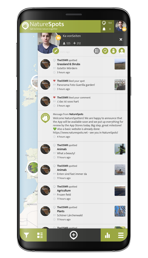
Observing and learning about nature is fun and can help to protect our environment. In the NatureSpots App, you can put up all kinds of nature sightings - from species to habitats. Join up and help to build a biodiversity data set and share your photos!

JOIN THE COMMUNITY

Create your account or download the NatureSpots App for your Smartphone now to join the community!

NatureSpots App with plants and leaves

Get the free App!

NatureSpots is a non-profit and 100% community-driven project. We run it because we love to discover our world and share our findings with others. The app does not contain any ads and we do not get money from this project at all. Download the App on your Smartphone and join up!

Android AppStoreBadge 150x45px IOS AppStoreBadge 150x45px

Want to partner up for a new biodiversity experience?

We are looking for partners, who are interested in biodiversity data, Citizen Science and being part of a modern and unique app. NatureSpots App is running on the SPOTTERON Citizen Science platform and provides a wide range of interactive features. For partners, we can provide communication tools, access to the data administration interface and download of occurrence records without any costs.

Please get in contact via office@spotteron.net if you are interested in joining NatureSpots with your organization! Let's talk about the future of biodiversity monitoring and how we can work best together!